
King Tides in the Bay Area: What to Expect, in Photos
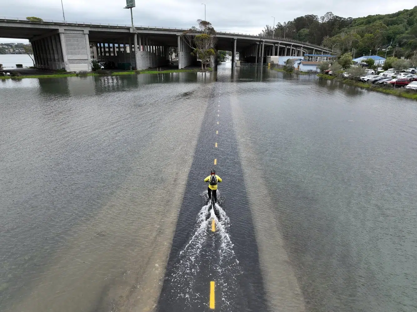
The highest tides of the year are arriving in the Bay Area, and this week’s are forecast to be unusually high. The National Weather Service has issued a Coastal Flood Warning for the San Francisco and San Pablo Bay shorelines from Monday, November 23 through Thursday, November 26, 2026, and says the predictions are “approaching the highest tide ever recorded.” If you live, commute or run a business near the shoreline in San Francisco or Marin County, here is what a king tide can look like, in photographs I made for Agence France-Presse during the king tide of January 3, 2022.
What a king tide is
King tides occur when the Earth, moon and sun align in orbit to produce unusually high water levels. They are predictable, they arrive a few times each winter, and they can cause local tidal flooding with no storm at all. That is the strange part of photographing one. Nothing in these pictures is rushing or breaking. The water is simply where the path used to be.
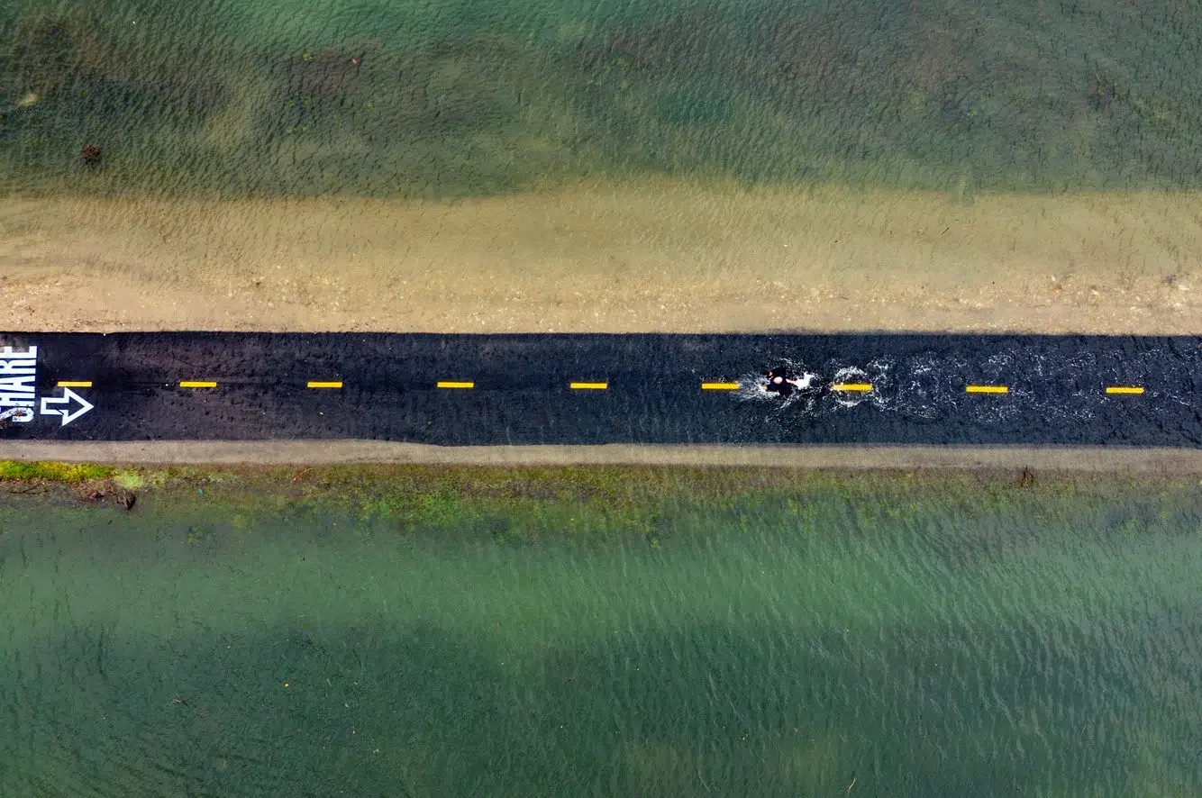
Where the water goes
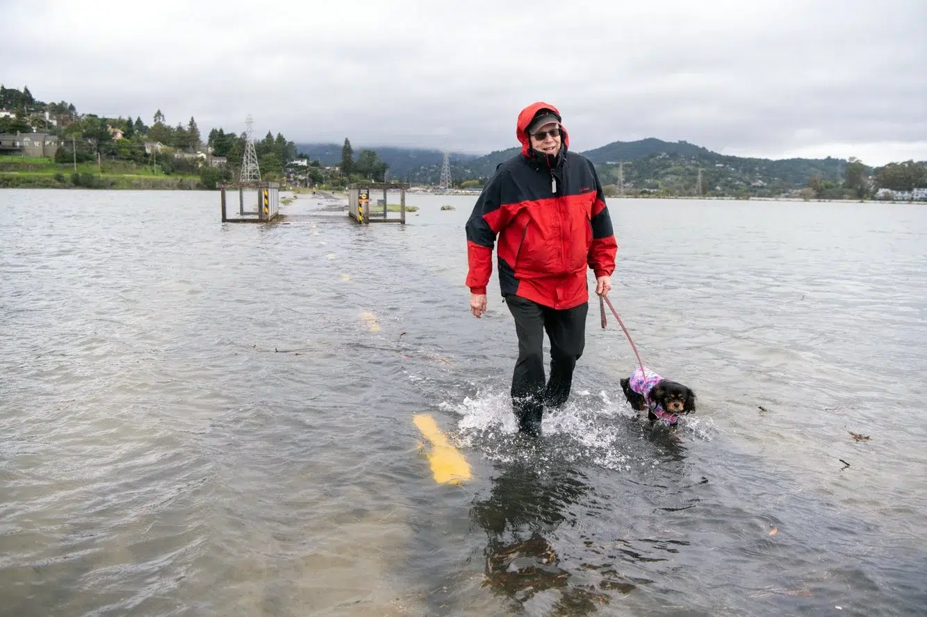
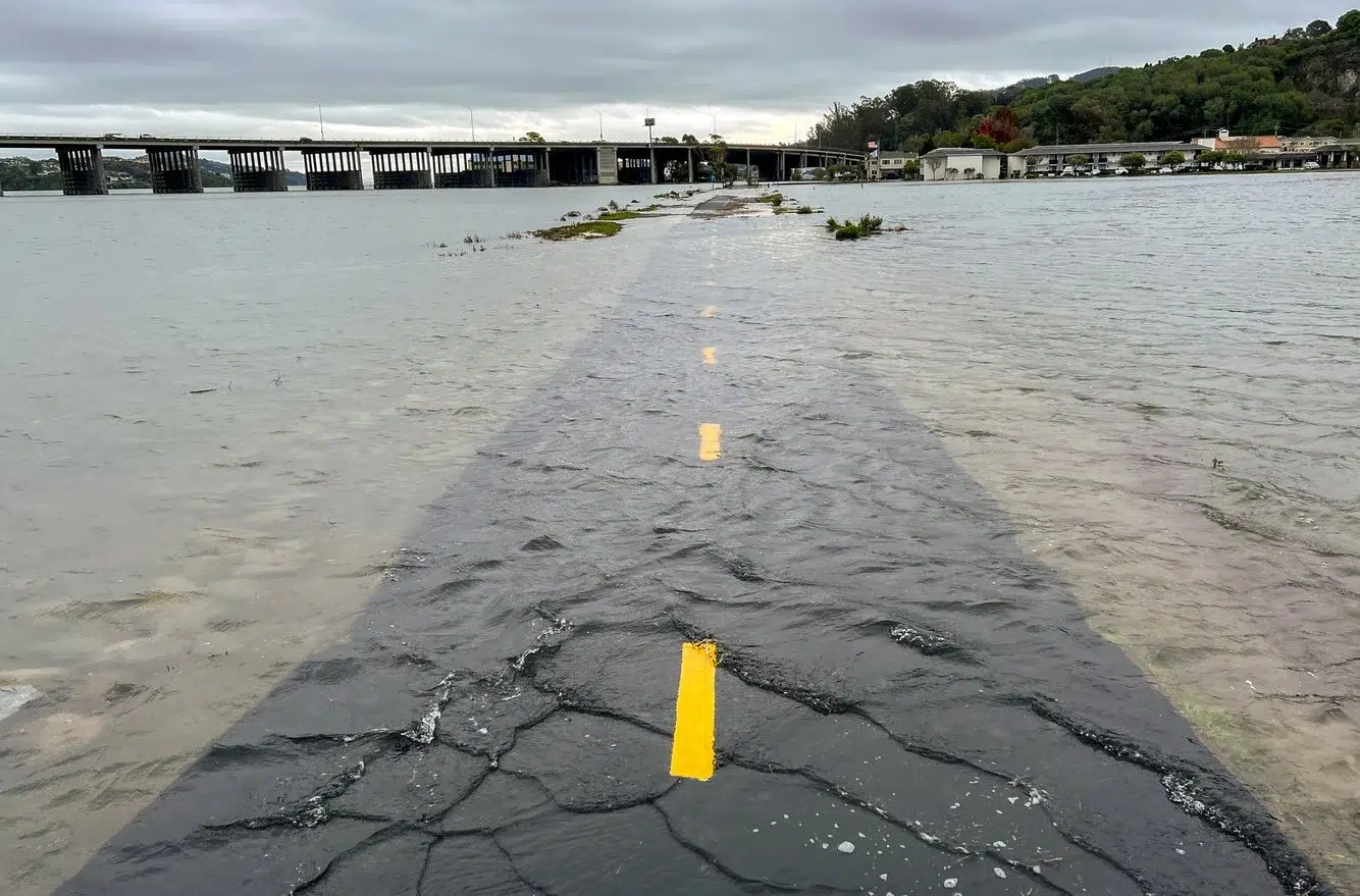
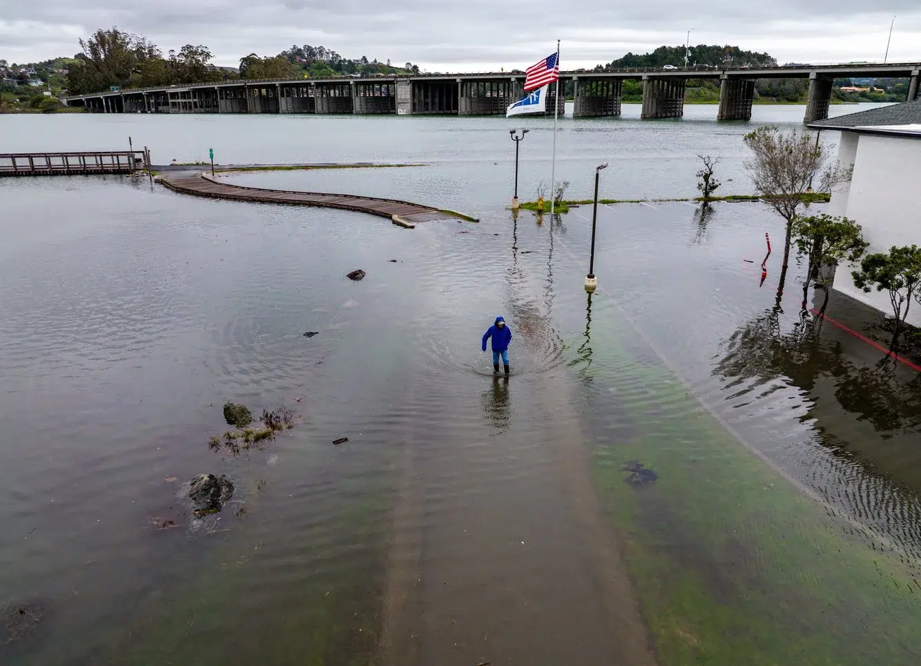
All of these frames are from Mill Valley, along the Sausalito/Mill Valley bike path and the roads beside it. It is one of the most reliable places in the Bay Area to see a king tide, because the path sits low along the edge of Richardson Bay. When the tide peaks, the bay covers it.
People keep using it anyway. In the 2022 pictures a cyclist rides through the water, a runner keeps running, and Reed Freidinger walks his dog along a path that has become part of the bay. On the road nearby, drivers push through ocean water.
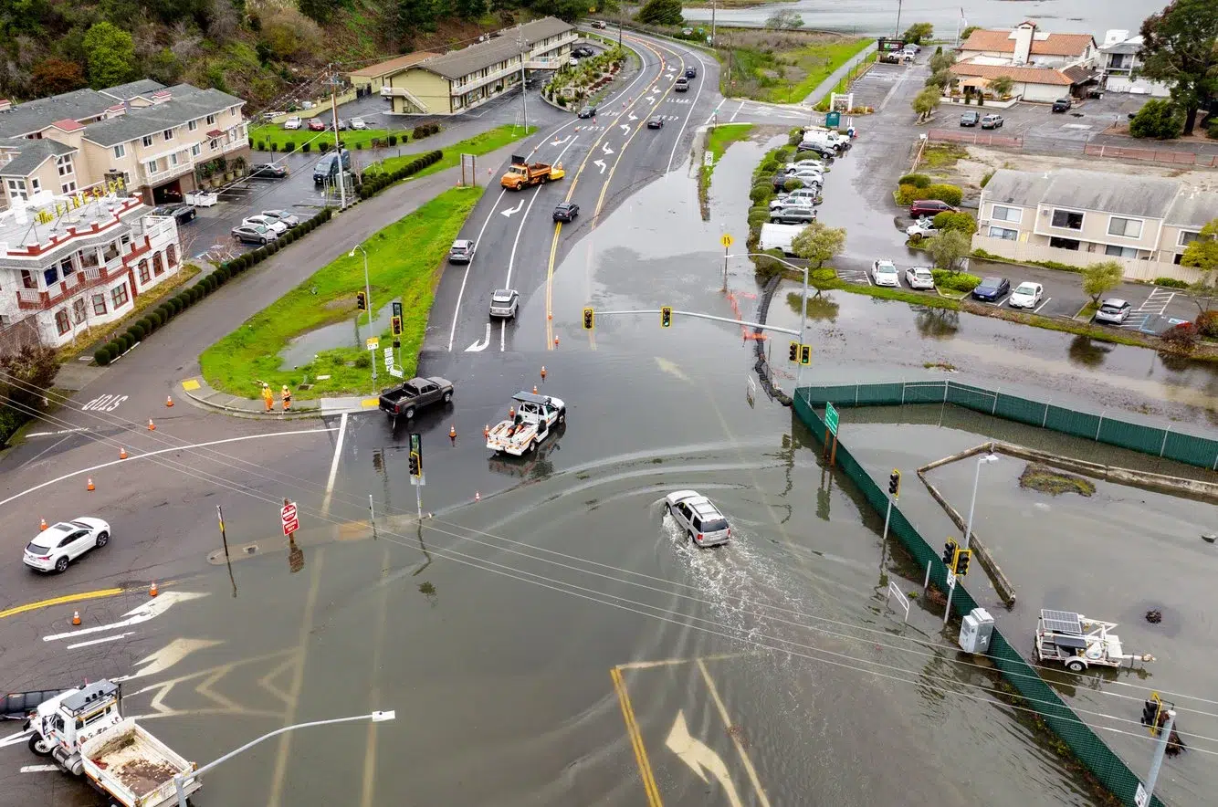
What to expect this week
This week’s forecast is more serious than the 2022 tide in these pictures. As of Saturday, November 21, the National Weather Service office for the San Francisco Bay Area is warning of the following:
- Coastal Flood Warning for the San Francisco and San Pablo Bay shorelines from 6 a.m. Monday, November 23 to 4 p.m. Thursday, November 26. A Coastal Flood Advisory covers the days before it and the Pacific coast.
- Up to 2.8 feet of water above ground level is possible in low-lying areas near shorelines and tidal waterways.
- Forecast high tides at the San Francisco tide gauge: 8.0 feet at 9:25 a.m. Monday, 8.4 feet at 10:05 a.m. Tuesday, 8.6 feet at 10:49 a.m. Wednesday and 8.2 feet at 11:38 a.m. Thursday. Those figures include up to 1.6 feet of surge on top of the astronomical tide.
- Impacts: flooding of low-lying infrastructure, numerous road closures and coastal erosion.
- Rain from a system on Tuesday and Wednesday may add to the flooding where it meets the high tides.
High tide arrives up to 90 minutes later inside the bay than at the coast, so check the NOAA tide predictions for the station nearest you. The weather service’s guidance is simple: protect flood-prone property, allow extra travel time, and do not drive around barricades or through water of unknown depth. Salt water is hard on cars even when it looks shallow.
Marin has already had a preview. KQED reported that the Mill Valley-Sausalito pathway and the Manzanita exit off Highway 101 flooded on November 13. The California King Tides Project lists more king tide dates on December 23 to 25 and January 21 to 22.
Sources: National Weather Service San Francisco Bay Area, Coastal Flood Warning issued November 21, 2026. KQED, November 13, 2026. California King Tides Project. Forecasts change, so check the weather service for the latest.
Why I photograph them from the air
From the ground, a flooded path looks like a puddle. From above, you can see that the shoreline itself has moved. Several of these pictures are aerials for that reason: the line between land and bay is the story, and the air is the only place you can see all of it at once. A person in the frame matters just as much. The cyclist gives the water a scale that an empty path never would.
A preview of the future
King tides are natural, but they are also a look ahead. Over time, sea level rise is raising the height of tidal systems, which means the water levels we see a few mornings a year now are expected to become ordinary high tides later. That is why scientists and planners ask the public to photograph them, and why news agencies send photographers to the same low spots every winter.
I will be out photographing this week’s king tides around San Francisco and Marin County and will add the new pictures to this page. More of my flood and storm work is in the flood photography gallery, and more aerial work is on the drone and aerial photography page. To use any of these images, see photo licensing.
Frequently asked questions
When are the king tides in the San Francisco Bay Area in winter 2026 to 2027?
The California King Tides Project lists November 24 to 26, 2026, December 23 to 25, 2026, and January 21 to 22, 2027. High tide times vary by location, so check NOAA tide predictions for the nearest station.
Where can you see king tide flooding in Marin County?
The Sausalito/Mill Valley bike path and nearby low roads along Richardson Bay in Mill Valley regularly flood during king tides. Josh Edelson photographed that flooding for AFP on January 3, 2022.
Can I license these king tide photos?
Yes. Josh Edelson licenses his news and aerial photography for editorial and commercial use. See the photo licensing page or get in touch with the image you need and how you plan to use it.